Point Sublime Sunrise as a new window
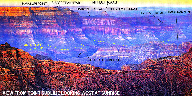
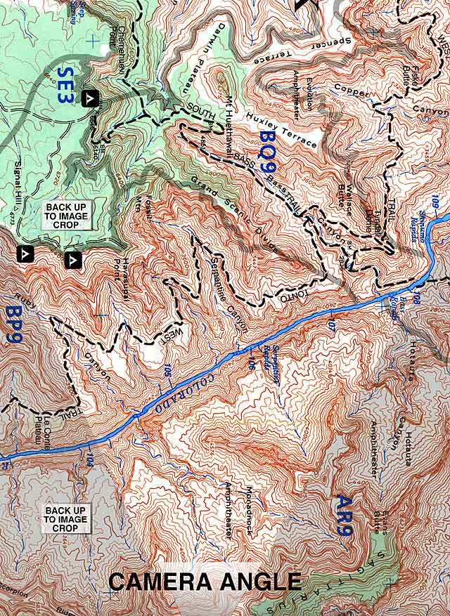
Hiking in the Grand Canyon affords a wonderful opportunity to orientate yourself with a topo map. The sheer walls, plateaus and various outcroppings give you a very easy reference to follow. Below is an example of an image cross section of the Grand Canyon looking from Point Sublime towards the South Bass Canyon (area where our "A Group" will be hiking for the week). Compare the Topo Map below to the image of the Point Sublime Sunrise.
Point Sublime Sunrise
as a new window
BACK TO GRAND CANYON LINKS PAGE
Maps