|
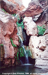
ELVES CHASM FALLS
TRIP
REPORT |
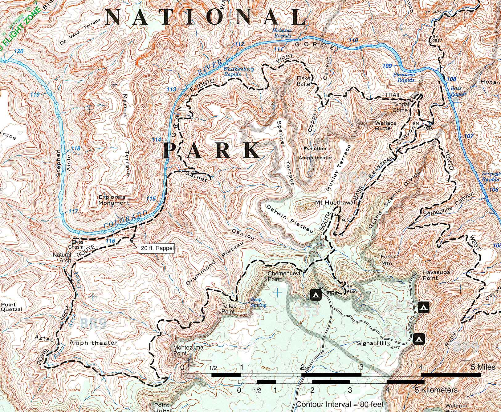
| South Bass Trip |
| This trip has the
most variables because of the complexity of access to the trailhead,
and the fact that all camping in this area is at large - or basically,
if you can find a flat spot that you want to sleep on, you're
home. Based on the idea that we have ideal conditions, the trip
might involve: |
| South Bass Trailhead elevation |
@ 6646' above sea
level |
| First day hike 10 miles to the Colorado
River with an elevation loss of |
4446 |
| Day two, hike 9 1/2 miles to Garnet
Canyon, variable elevation of |
± 1500 |
| Day three hike 6 miles in and out
of Elves Chasm, 3 miles each way with comparatively minimal elevation
gain/loss. |
± 1500 |
| Day four hike to South Bass Camp
at river, or camp on Tonto Platform 1500 above River. Camping
difference of 1500 vertical and 1 mile. |
|
| Day five, hike out of canyon to South
Bass Trailhead distance of 9 - 10 miles, or |
3950 - 4450 |
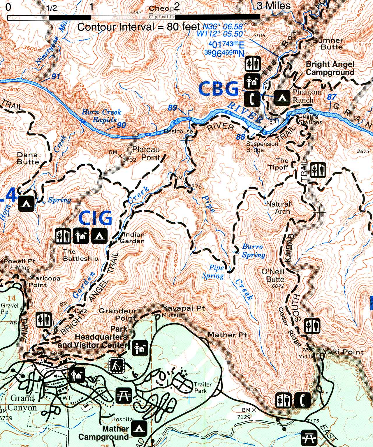
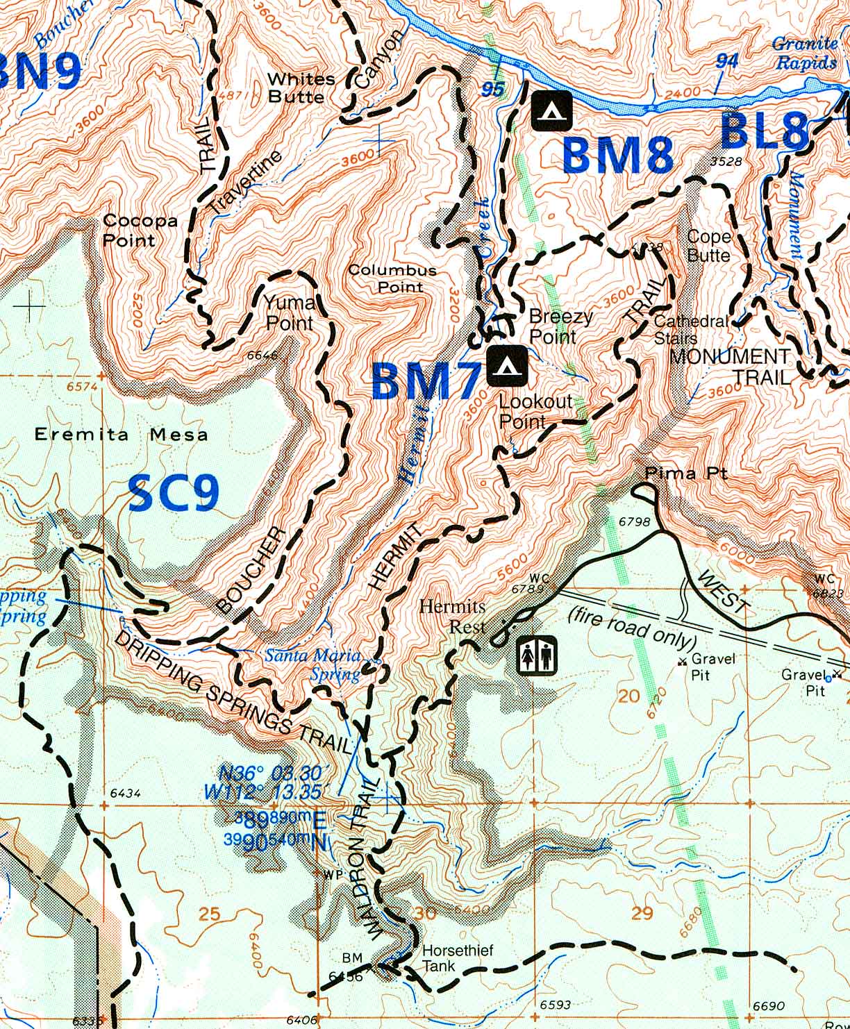
 South Bass Trail Map 9" x 7 1/4"
@ 72 DPI 148K - RGB .JPEG File
South Bass Trail Map 9" x 7 1/4"
@ 72 DPI 148K - RGB .JPEG File
South Bass Trail Map 22 1/2" x 18 1/2" @ 72 DPI 700K - RGB .JPEG
File |

Maps
